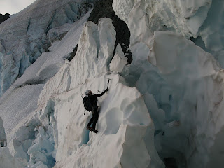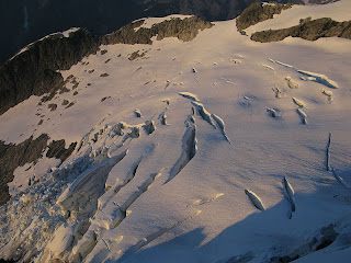
--It's not often we see TR's for this route. You probably won't see one for three years so better read it now. Check out this trip report for the Price Glacier on Shuksan. Another TR for Shuksan can be found here, via the Sulphide Glacier.
--A Bugaboos report from Public Mountain Conditions Report:Getting into East Creek from the Pigeon Howser Col is still pretty straight forward with mostly snow on the upper half and quite a bit of exposed ice on the lower half of the glacier. We managed to get around without crampons but only because we were not experiencing strong overnight freezes due to the thick smoke and warm temperatures. There has been quite a bit of recent ice and rock-fall from the South Howser Tower on the skiers right side of the glacier as you get closer to the Minaret and East Creek camp. If you are heading to the west face of the North Howser Tower, the glacier below the rappels from the Howser Bivy Boulder is still mostly snow covered and easier travel than it often is this time of year. It is still a very steep slope that is very exposed to rock-fall from the glacier below the Central Howser and can be difficult to manage if frozen.
--Forecast for the West Slope of the Cascades.
--Forecast for the East Slope of the Cascades.
--Webcam for Leavenworth and the Stuart Range.
--Forecast for Mount Rainier.-- Route and Conditions Report from Mt. Baker Rangers: Mount Baker Climbing Blog.
--Forest Service Road Report for Mount Baker-Snoqualmie National Forest.
--Mount Saint Helens, Mount Adams conditions and recreation report.
--Webcams for Mount Rainier National Park, North Cascades National Park, Leavenworth.
--An up-to-date ski and snow report for the Northwest may be found here.
--Up-to-date Pacific Northwest ice conditions may be found here.
SIERRA:
-- Here is a report from AAI Lead Guide Ian McEleney for Venusian Blind:
"Cynthia and I met up and did a quick gear check in Bishop before driving down to the trailhead outside Big Pine. We've climbed together before, so Cynthia had all of her gear and food and gear check went quickly. The first part of the hike in to Second Lake is pretty sunny, but there was a nice breeze to keep us cool. After a mile and a half the trail starts following a creek and we saw lots of great wildflowers, including Leopard Lily and Monkshood. We arrived at Second Lake with time to enjoy the views of the arete, the surrounding peaks, and the lovely lake itself.
The next morning we woke early and made quick work of the talus approach to the route. The first few hundred feet of the route take one up mixed third and fourth class terrain and into the sun. At a suitable ledge we roped up and started pitching out the 5th class climbing. Almost every pitch has some cool 5.6 to 5.7 climbing. The movement is varied with excellent crack, face, and friction climbing. The exposure is ever present but not overwhelming. The first 3/4 of the route are relatively straightforward. Near the top the route gets horizontal and passes through some towers and notches. This terrain is complicated, but Cynthia's climbing experience let us keep our momentum to the top.
The descent is scrambling with one rappel. After the rappel, the standard Sierra talus hike took us back to camp, where we could soak our tired feet in the lake."
--A great Whitney report can be found here, Mountaineers Route beta solo. Remember sox and your car keys!
--For up-to-date avalanche and weather reports in the Eastern Sierra, click here.
--Webcams for Bishop, June Lake, Mammoth Mountain, Mono Lake, Tioga Pass.
ALPS:
--Chamonix and Mont Blanc Regional Forecasts may be found here.
--Webcams for Chamonix Valley, Zermatt and the Matterhorn.
RED ROCK CANYON:
--Forecast and average temperatures for Red Rock Canyon.
--Webcam for Red Rock Canyon National Conservation Area.--The late exit and overnight permit number for Red Rock Canyon is 702-515-5050. If there is any chance that you will be inside the park after closing, be sure to call this number so that you don't get a ticket.--The entrance to the scenic drive had a parking area for those who wanted to carpool up until approximately April of 2009. That lot has now become employee parking and people who want to carpool are required to park at the lot outside the Scenic Drive exit.
--The scenic drive currently opens its gates at 6 in the morning.
JOSHUA TREE:
-- Some campgrounds will close for the summer season. See here for more info.
--Forecast and average temperatures for Joshua Tree National Park.
--Webcam for Joshua Tree National Park.
ALASKA RANGE:
-- For the most current updates on Alaska, please see our Dispatch Blog.
--Forecast for Denali.

